 vesseltracker.com
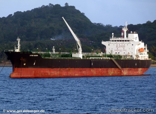
Vessel PINE MEADOW IMO: 9478688, MMSI: 255915876 Oil/Chemical Tanker
UTC, 22.20641, -97.70087, course: 127, speed: 0
UTC, 22.20632, -97.70105, course: 123, speed: 0.1
2026-02-26 20:01:01 UTC, 22.20610, -97.70126, course: -1, speed: 0.1
Live AIS position:
UTC. Near Benito Juarez),
updated 2026-02-26 20:01:01 UTC.
Find the position of the vessel PINE MEADOW on the map. The latter are known coordinates and path.
marine traffic ship tracker show on live map
The current position of vessel PINE MEADOW is 22.20610 lat / -97.70126 lng. Updated: 2026-02-26 20:01:01 UTCCurrently sailing under the flag of Portugal
Details:
Last coordinates of the vessel:
UTC, 22.20653, -97.70067, course: 138, speed: 0.1UTC, 22.20641, -97.70087, course: 127, speed: 0
UTC, 22.20632, -97.70105, course: 123, speed: 0.1
2026-02-26 20:01:01 UTC, 22.20610, -97.70126, course: -1, speed: 0.1