 vesseltracker.com
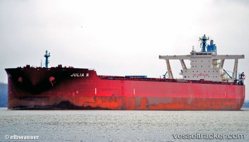
Vessel Julia N IMO: 9479369, MMSI: 636014332 Ore Carrier
UTC, -2.66040, -39.13853, course: 298, speed: 9
UTC, -2.52652, -39.37975, course: 301, speed: 8.7
2026-03-21 21:32:42 UTC, -2.36923, -39.65080, course: 297, speed: 10.7
Live Vessel Julia N Analytics (details, animations, etc.)
Live AIS position: UTC. 37 nm NE of Itarema), updated 2026-03-21 21:32:42 UTC.Find the position of the vessel Julia N on the map. The latter are known coordinates and path.
marine traffic ship tracker show on live map
The current position of vessel Julia N is -2.36923 lat / -39.65080 lng. Updated: 2026-03-21 21:32:42 UTCDetails:
Last coordinates of the vessel:
UTC, -2.86981, -38.72491, course: 301, speed: 11.4UTC, -2.66040, -39.13853, course: 298, speed: 9
UTC, -2.52652, -39.37975, course: 301, speed: 8.7
2026-03-21 21:32:42 UTC, -2.36923, -39.65080, course: 297, speed: 10.7