 vesseltracker.com
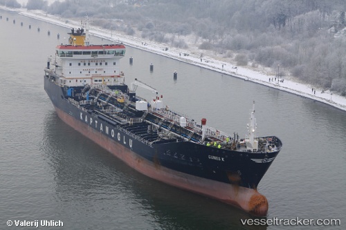
Vessel GUNES K IMO: 9479553, MMSI: 249672000 Oil/Chemical Tanker
UTC, 0.52498, 59.87241, course: 15, speed: 11.1
UTC, 0.92429, 59.91953, course: 16, speed: 11.1
2026-02-23 11:07:55 UTC, 1.17140, 59.95121, course: 16, speed: 11.1
Live AIS position:
UTC. 264 nm N of Akpo),
updated 2026-02-23 11:07:55 UTC.
Find the position of the vessel GUNES K on the map. The latter are known coordinates and path.
marine traffic ship tracker show on live map
The current position of vessel GUNES K is 1.17140 lat / 59.95121 lng. Updated: 2026-02-23 11:07:55 UTCCurrently sailing under the flag of Malta
Details:
Last coordinates of the vessel:
UTC, -0.04890, 59.81800, course: 13, speed: 10.8UTC, 0.52498, 59.87241, course: 15, speed: 11.1
UTC, 0.92429, 59.91953, course: 16, speed: 11.1
2026-02-23 11:07:55 UTC, 1.17140, 59.95121, course: 16, speed: 11.1