 vesseltracker.com
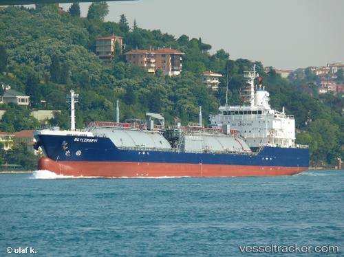
Vessel Beylerbeyi IMO: 9480370, MMSI: 271042996 Lpg Tanker
UTC, 11.33667, -79.66333, course: -1, speed: 12
UTC, 10.95568, -79.71532, course: 186, speed: 12
2026-02-26 03:50:11 UTC, 10.62833, -79.73833, course: -1, speed: 11
Live AIS position:
UTC. 61 nm N of Isla Grande),
updated 2026-02-26 03:50:11 UTC.
Find the position of the vessel Beylerbeyi on the map. The latter are known coordinates and path.
marine traffic ship tracker show on live map
The current position of vessel Beylerbeyi is 10.62833 lat / -79.73833 lng. Updated: 2026-02-26 03:50:11 UTCDetails:
Last coordinates of the vessel:
UTC, 11.91667, -79.60500, course: -1, speed: 12UTC, 11.33667, -79.66333, course: -1, speed: 12
UTC, 10.95568, -79.71532, course: 186, speed: 12
2026-02-26 03:50:11 UTC, 10.62833, -79.73833, course: -1, speed: 11