 vesseltracker.com
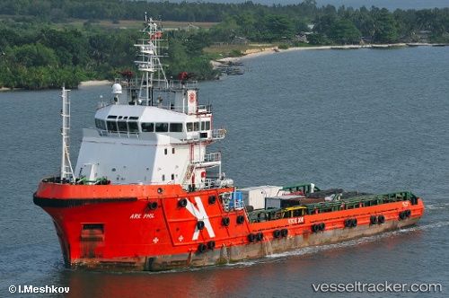
Vessel Markabi Phil IMO: 9482457, MMSI: 312516000 Offshore Tug Supply Ship
UTC, 20.77143, 106.89287, course: -1, speed: 0
UTC, 20.77140, 106.89283, course: -1, speed: 0
2026-02-24 09:03:19 UTC, 20.77141, 106.89285, course: -1, speed: 0
Live AIS position:
UTC. Near Nam Hai Dinh Vu Port),
updated 2026-02-24 09:03:19 UTC.
Find the position of the vessel Markabi Phil on the map. The latter are known coordinates and path.
marine traffic ship tracker show on live map
The current position of vessel Markabi Phil is 20.77141 lat / 106.89285 lng. Updated: 2026-02-24 09:03:19 UTCDetails:
Last coordinates of the vessel:
UTC, 20.77146, 106.89282, course: -1, speed: 0UTC, 20.77143, 106.89287, course: -1, speed: 0
UTC, 20.77140, 106.89283, course: -1, speed: 0
2026-02-24 09:03:19 UTC, 20.77141, 106.89285, course: -1, speed: 0