 vesseltracker.com
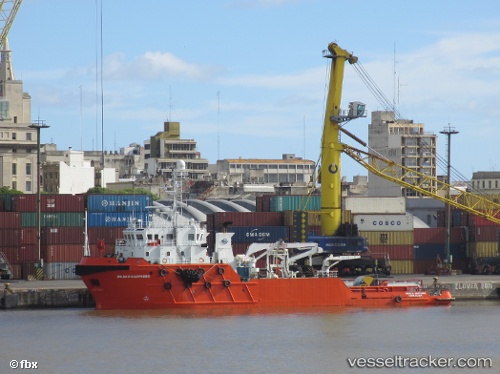
Vessel OCEAN DEE IMO: 9486037, MMSI: 258017000 Offshore Tug/Supply Ship
UTC, -33.78167, -50.92667, course: -1, speed: 3
UTC, -33.77833, -50.85500, course: -1, speed: 3
2026-02-25 03:27:02 UTC, -33.77333, -50.69333, course: -1, speed: 4
Live AIS position:
UTC. 125 nm SE of Rio Grande),
updated 2026-02-25 03:27:02 UTC.
Find the position of the vessel OCEAN DEE on the map. The latter are known coordinates and path.
marine traffic ship tracker show on live map
The current position of vessel OCEAN DEE is -33.77333 lat / -50.69333 lng. Updated: 2026-02-25 03:27:02 UTCCurrently sailing under the flag of Norway (NIS)
OCEAN DEE built in 2007 year
Deadweight:
1200 tDetails:
Last coordinates of the vessel:
UTC, -33.86833, -50.94833, course: -1, speed: 3UTC, -33.78167, -50.92667, course: -1, speed: 3
UTC, -33.77833, -50.85500, course: -1, speed: 3
2026-02-25 03:27:02 UTC, -33.77333, -50.69333, course: -1, speed: 4