 vesseltracker.com
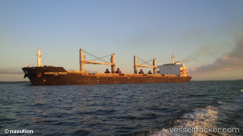
Vessel Magnum Power IMO: 9488968, MMSI: 538003223 Bulk Carrier
UTC, 10.37586, -159.94110, course: 50, speed: 60.7
UTC, 10.37586, -159.94110, course: 50, speed: 60.7
2026-02-20 18:31:50 UTC, 10.37586, -159.94110, course: 50, speed: 60.7
Live AIS position:
UTC. 393 nm N of Fanning Island),
updated 2026-02-20 18:31:50 UTC.
Find the position of the vessel Magnum Power on the map. The latter are known coordinates and path.
marine traffic ship tracker show on live map
The current position of vessel Magnum Power is 10.37586 lat / -159.94110 lng. Updated: 2026-02-20 18:31:50 UTCDetails:
Last coordinates of the vessel:
UTC, 15.19975, -146.62270, course: -1, speed: 99.1UTC, 10.37586, -159.94110, course: 50, speed: 60.7
UTC, 10.37586, -159.94110, course: 50, speed: 60.7
2026-02-20 18:31:50 UTC, 10.37586, -159.94110, course: 50, speed: 60.7