 vesseltracker.com
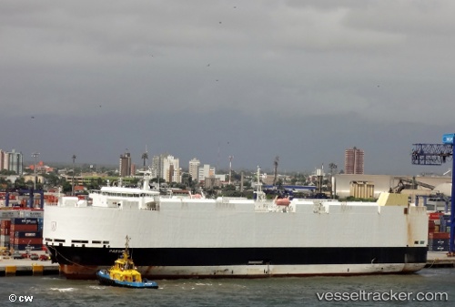
Vessel VIKING PASSAMA IMO: 9491874, MMSI: 538009816 Vehicles Carrier
UTC, -16.60617, 160.96413, course: 147, speed: 17.2
UTC, -17.03146, 161.24760, course: 147, speed: 17
2026-02-13 18:17:22 UTC, -17.70666, 161.69939, course: 148, speed: 16.5
Live AIS position:
UTC. 164 nm NW of Wala),
updated 2026-02-13 18:17:22 UTC.
Find the position of the vessel VIKING PASSAMA on the map. The latter are known coordinates and path.
marine traffic ship tracker show on live map
The current position of vessel VIKING PASSAMA is -17.70666 lat / 161.69939 lng. Updated: 2026-02-13 18:17:22 UTCCurrently sailing under the flag of Marshall Islands
VIKING PASSAMA built in 2012 year
Deadweight:
12806 tDetails:
Last coordinates of the vessel:
UTC, -16.14540, 160.65758, course: 148, speed: 17UTC, -16.60617, 160.96413, course: 147, speed: 17.2
UTC, -17.03146, 161.24760, course: 147, speed: 17
2026-02-13 18:17:22 UTC, -17.70666, 161.69939, course: 148, speed: 16.5