 vesseltracker.com
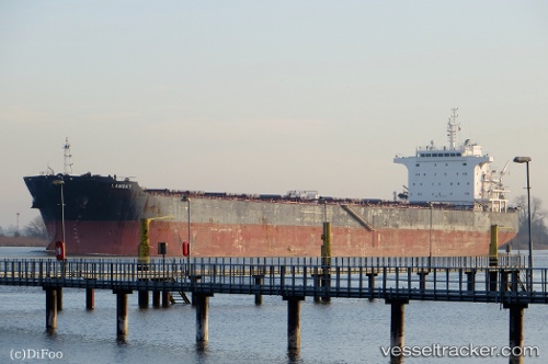
Vessel Lambay IMO: 9493925, MMSI: 636015008 Bulk Carrier
UTC, 22.51833, 39.08833, course: -1, speed: 0
UTC, 22.51843, 39.08896, course: 178, speed: 0
2026-02-22 15:51:58 UTC, 22.51833, 39.08833, course: -1, speed: 0
Live AIS position:
UTC. Near King Abdullah),
updated 2026-02-22 15:51:58 UTC.
Find the position of the vessel Lambay on the map. The latter are known coordinates and path.
marine traffic ship tracker show on live map
The current position of vessel Lambay is 22.51833 lat / 39.08833 lng. Updated: 2026-02-22 15:51:58 UTCCurrently sailing under the flag of Liberia
Lambay built in 2011 year
Deadweight:
75200 tDetails:
Last coordinates of the vessel:
UTC, 22.51847, 39.08901, course: 178, speed: 0UTC, 22.51833, 39.08833, course: -1, speed: 0
UTC, 22.51843, 39.08896, course: 178, speed: 0
2026-02-22 15:51:58 UTC, 22.51833, 39.08833, course: -1, speed: 0