 vesseltracker.com
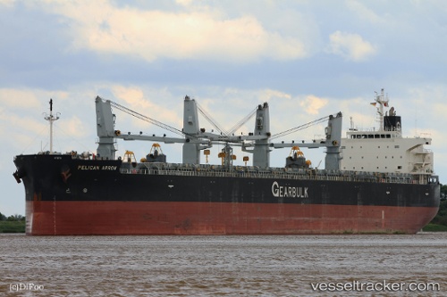
Vessel Pelican Arrow IMO: 9495923, MMSI: 354726000 General Cargo Ship
UTC, -6.49788, -124.93232, course: 290, speed: 11.9
UTC, -6.37388, -125.27105, course: 290, speed: 11.5
2026-02-01 06:06:27 UTC, -6.23110, -125.67175, course: 291, speed: 11.4
Live AIS position:
UTC. Open sea (no nearby ports in database)),
updated 2026-02-01 06:06:27 UTC.
Find the position of the vessel Pelican Arrow on the map. The latter are known coordinates and path.
marine traffic ship tracker show on live map
The current position of vessel Pelican Arrow is -6.23110 lat / -125.67175 lng. Updated: 2026-02-01 06:06:27 UTCCurrently sailing under the flag of Panama
Pelican Arrow built in 2011 year
Deadweight:
62942 tDetails:
Last coordinates of the vessel:
UTC, -6.61905, -124.59343, course: 288, speed: 11.8UTC, -6.49788, -124.93232, course: 290, speed: 11.9
UTC, -6.37388, -125.27105, course: 290, speed: 11.5
2026-02-01 06:06:27 UTC, -6.23110, -125.67175, course: 291, speed: 11.4