 vesseltracker.com
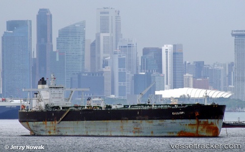
Vessel Kalliopi IMO: 9508859, MMSI: 248869000 Crude Oil Tanker
UTC, 25.39382, 56.59273, course: 184, speed: 0.1
UTC, 25.39382, 56.59273, course: 184, speed: 0.1
2026-02-03 08:06:14 UTC, 25.39382, 56.59273, course: 184, speed: 0.1
Live AIS position:
UTC. Near Offshore Fujairah),
updated 2026-02-03 08:06:14 UTC.
Find the position of the vessel Kalliopi on the map. The latter are known coordinates and path.
marine traffic ship tracker show on live map
The current position of vessel Kalliopi is 25.39382 lat / 56.59273 lng. Updated: 2026-02-03 08:06:14 UTCCurrently sailing under the flag of Malta
Kalliopi built in 2010 year
Deadweight:
296659 tDetails:
Last coordinates of the vessel:
UTC, 25.39382, 56.59236, course: 175, speed: 0.1UTC, 25.39382, 56.59273, course: 184, speed: 0.1
UTC, 25.39382, 56.59273, course: 184, speed: 0.1
2026-02-03 08:06:14 UTC, 25.39382, 56.59273, course: 184, speed: 0.1