 vesseltracker.com
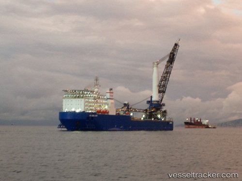
Vessel TIMAS 1201 IMO: 9513579, MMSI: 525500783 Pipe-Layer
UTC, 1.11183, 104.17450, course: 7, speed: 0.1
UTC, 1.11160, 104.17501, course: 36, speed: 0.2
2026-01-25 20:04:01 UTC, 1.11154, 104.17478, course: 7, speed: 0.1
Live AIS position:
UTC. Near KABIL),
updated 2026-01-25 20:04:01 UTC.
Find the position of the vessel TIMAS 1201 on the map. The latter are known coordinates and path.
marine traffic ship tracker show on live map
The current position of vessel TIMAS 1201 is 1.11154 lat / 104.17478 lng. Updated: 2026-01-25 20:04:01 UTCCurrently sailing under the flag of Indonesia
TIMAS 1201 built in 2011 year
Deadweight:
9086 tDetails:
Last coordinates of the vessel:
UTC, 1.11180, 104.17454, course: 7, speed: 0.1UTC, 1.11183, 104.17450, course: 7, speed: 0.1
UTC, 1.11160, 104.17501, course: 36, speed: 0.2
2026-01-25 20:04:01 UTC, 1.11154, 104.17478, course: 7, speed: 0.1