 vesseltracker.com
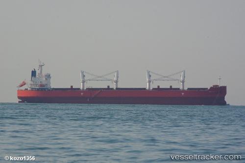
Vessel Baltic K IMO: 9514121, MMSI: 373107000 Bulk Carrier
UTC, 23.10532, 68.34988, course: 28, speed: 0
UTC, 23.10528, 68.35050, course: 14, speed: 0
2026-02-11 23:29:31 UTC, 23.10513, 68.34998, course: 17, speed: 0.1
Live AIS position:
UTC. 56 nm NW of Okha),
updated 2026-02-11 23:29:31 UTC.
Find the position of the vessel Baltic K on the map. The latter are known coordinates and path.
marine traffic ship tracker show on live map
The current position of vessel Baltic K is 23.10513 lat / 68.34998 lng. Updated: 2026-02-11 23:29:31 UTCDetails:
Last coordinates of the vessel:
UTC, 23.10538, 68.35010, course: 28, speed: 0UTC, 23.10532, 68.34988, course: 28, speed: 0
UTC, 23.10528, 68.35050, course: 14, speed: 0
2026-02-11 23:29:31 UTC, 23.10513, 68.34998, course: 17, speed: 0.1