 vesseltracker.com
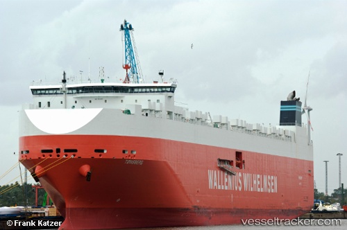
Vessel Tonsberg IMO: 9515383, MMSI: 249904000 Vehicles Carrier
UTC, 11.00805, -100.33526, course: 98, speed: 16.3
UTC, 10.93191, -99.88969, course: 98, speed: 16.7
2026-02-10 12:03:38 UTC, 10.81833, -99.32500, course: -1, speed: 17
Live AIS position:
UTC. 335 nm SW of Puerto Ángel),
updated 2026-02-10 12:03:38 UTC.
Find the position of the vessel Tonsberg on the map. The latter are known coordinates and path.
marine traffic ship tracker show on live map
The current position of vessel Tonsberg is 10.81833 lat / -99.32500 lng. Updated: 2026-02-10 12:03:38 UTCDetails:
Last coordinates of the vessel:
UTC, 11.11847, -100.95637, course: 100, speed: 15.4UTC, 11.00805, -100.33526, course: 98, speed: 16.3
UTC, 10.93191, -99.88969, course: 98, speed: 16.7
2026-02-10 12:03:38 UTC, 10.81833, -99.32500, course: -1, speed: 17