 vesseltracker.com
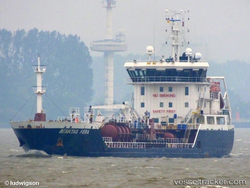
Vessel Bartok IMO: 9517458, MMSI: 209391000 Chemical Oil Products Tanker
UTC, 54.75637, -0.84785, course: 88, speed: 1.9
UTC, 54.74167, -0.79333, course: -1, speed: 1
2026-02-06 18:08:11 UTC, 54.70670, -0.71020, course: 92, speed: 1.7
Live AIS position:
UTC. Near Staithes),
updated 2026-02-06 18:08:11 UTC.
Find the position of the vessel Bartok on the map. The latter are known coordinates and path.
marine traffic ship tracker show on live map
The current position of vessel Bartok is 54.70670 lat / -0.71020 lng. Updated: 2026-02-06 18:08:11 UTCCurrently sailing under the flag of Cyprus
Bartok built in 2009 year
Deadweight:
4121 tDetails:
Last coordinates of the vessel:
UTC, 54.79412, -0.46490, course: 240, speed: 6.9UTC, 54.75637, -0.84785, course: 88, speed: 1.9
UTC, 54.74167, -0.79333, course: -1, speed: 1
2026-02-06 18:08:11 UTC, 54.70670, -0.71020, course: 92, speed: 1.7