 vesseltracker.com
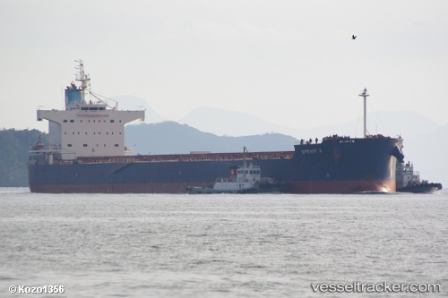
Vessel Efraim A IMO: 9520778, MMSI: 210043000 Bulk Carrier
UTC, 44.57167, 149.14166, course: -1, speed: 10
UTC, 44.28500, 148.57167, course: -1, speed: 10
2026-02-13 11:36:39 UTC, 44.13833, 148.26500, course: -1, speed: 11
Live AIS position:
UTC. 54 nm SE of Kasatka),
updated 2026-02-13 11:36:39 UTC.
Find the position of the vessel Efraim A on the map. The latter are known coordinates and path.
marine traffic ship tracker show on live map
The current position of vessel Efraim A is 44.13833 lat / 148.26500 lng. Updated: 2026-02-13 11:36:39 UTCCurrently sailing under the flag of Cyprus
Efraim A built in 2010 year
Deadweight:
82174 tDetails:
Last coordinates of the vessel:
UTC, 44.78111, 149.55798, course: 235, speed: 10.9UTC, 44.57167, 149.14166, course: -1, speed: 10
UTC, 44.28500, 148.57167, course: -1, speed: 10
2026-02-13 11:36:39 UTC, 44.13833, 148.26500, course: -1, speed: 11