 vesseltracker.com
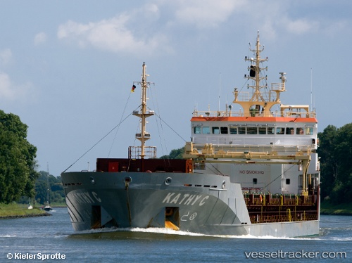
Vessel Kathy C IMO: 9523940, MMSI: 235075591 Multi Purpose Carrier
UTC, 35.99496, -6.33361, course: 295, speed: 6.4
UTC, 36.06833, -6.61167, course: -1, speed: 7
2026-02-14 13:36:25 UTC, 36.12073, -6.79469, course: 289, speed: 7.3
Live AIS position:
UTC. 21 nm W of Gibraltar),
updated 2026-02-14 13:36:25 UTC.
Find the position of the vessel Kathy C on the map. The latter are known coordinates and path.
marine traffic ship tracker show on live map
The current position of vessel Kathy C is 36.12073 lat / -6.79469 lng. Updated: 2026-02-14 13:36:25 UTCCurrently sailing under the flag of United Kingdom
Kathy C built in 2010 year
Deadweight:
6750 tDetails:
Last coordinates of the vessel:
UTC, 35.95978, -5.99159, course: 277, speed: 6.1UTC, 35.99496, -6.33361, course: 295, speed: 6.4
UTC, 36.06833, -6.61167, course: -1, speed: 7
2026-02-14 13:36:25 UTC, 36.12073, -6.79469, course: 289, speed: 7.3