 vesseltracker.com
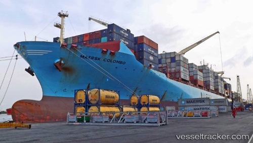
Vessel Maersk Colombo IMO: 9525390, MMSI: 566492000 Container Ship
UTC, 0.13654, 2.14286, course: 342, speed: 13.7
UTC, 0.68501, 1.93463, course: 340, speed: 13.6
2026-02-21 08:25:25 UTC, 1.21954, 1.73131, course: 344, speed: 13.4
Live AIS position:
UTC. 127 nm NE of SAO LUIS),
updated 2026-02-21 08:25:25 UTC.
Find the position of the vessel Maersk Colombo on the map. The latter are known coordinates and path.
marine traffic ship tracker show on live map
The current position of vessel Maersk Colombo is 1.21954 lat / 1.73131 lng. Updated: 2026-02-21 08:25:25 UTCDetails:
Last coordinates of the vessel:
UTC, -0.09739, 2.23073, course: 342, speed: 13.9UTC, 0.13654, 2.14286, course: 342, speed: 13.7
UTC, 0.68501, 1.93463, course: 340, speed: 13.6
2026-02-21 08:25:25 UTC, 1.21954, 1.73131, course: 344, speed: 13.4