 vesseltracker.com
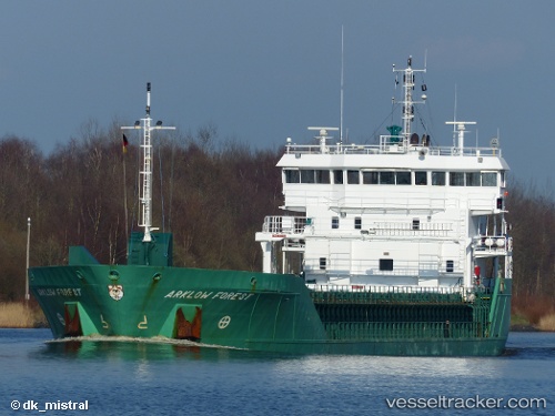
Vessel Arklow Forest IMO: 9527685, MMSI: 250002443 Multi Purpose Carrier
UTC, 52.26320, -5.62930, course: 197, speed: 11.1
UTC, 52.26320, -5.62930, course: 197, speed: 11.1
2026-02-25 05:14:07 UTC, 52.26320, -5.62930, course: 197, speed: 11.1
Live AIS position:
UTC. 26 nm NW of Porthgain),
updated 2026-02-25 05:14:07 UTC.
Find the position of the vessel Arklow Forest on the map. The latter are known coordinates and path.
marine traffic ship tracker show on live map
The current position of vessel Arklow Forest is 52.26320 lat / -5.62930 lng. Updated: 2026-02-25 05:14:07 UTCCurrently sailing under the flag of Ireland
Arklow Forest built in 2011 year
Deadweight:
4500 tDetails:
Last coordinates of the vessel:
UTC, 52.49853, -5.48134, course: 200, speed: 10.1UTC, 52.26320, -5.62930, course: 197, speed: 11.1
UTC, 52.26320, -5.62930, course: 197, speed: 11.1
2026-02-25 05:14:07 UTC, 52.26320, -5.62930, course: 197, speed: 11.1