 vesseltracker.com
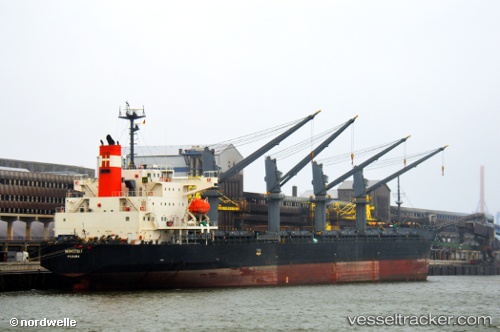
Vessel Mimitsu IMO: 9527958, MMSI: 373471000 General Cargo Ship
UTC, 37.16514, 23.83554, course: 33, speed: 11
UTC, 37.35057, 24.01522, course: 32, speed: 11.5
2026-02-24 00:13:43 UTC, 37.75832, 24.34333, course: 52, speed: 11.2
Live AIS position:
UTC. Near KEA),
updated 2026-02-24 00:13:43 UTC.
Find the position of the vessel Mimitsu on the map. The latter are known coordinates and path.
marine traffic ship tracker show on live map
The current position of vessel Mimitsu is 37.75832 lat / 24.34333 lng. Updated: 2026-02-24 00:13:43 UTCCurrently sailing under the flag of Panama
Mimitsu built in 2012 year
Deadweight:
38477 tDetails:
Last coordinates of the vessel:
UTC, 36.72827, 23.49932, course: 25, speed: 11.5UTC, 37.16514, 23.83554, course: 33, speed: 11
UTC, 37.35057, 24.01522, course: 32, speed: 11.5
2026-02-24 00:13:43 UTC, 37.75832, 24.34333, course: 52, speed: 11.2