 vesseltracker.com
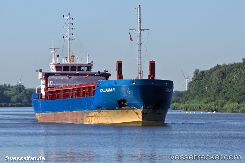
Vessel 'CALAMAR' IMO: 9528512, MMSI: 209732000
UTC, 52.96952, 0.30172, course: 61, speed: 0.1
UTC, 52.97096, 0.30419, course: 172, speed: 0.1
2026-02-05 23:57:16 UTC, 52.97100, 0.30578, course: 161, speed: 0
Live AIS position:
UTC. Near Friskney),
updated 2026-02-05 23:57:16 UTC.
Find the position of the vessel 'CALAMAR' on the map. The latter are known coordinates and path.
marine traffic ship tracker show on live map
The current position of vessel 'CALAMAR' is 52.97100 lat / 0.30578 lng. Updated: 2026-02-05 23:57:16 UTCDetails:
Last coordinates of the vessel:
UTC, 52.98148, 0.33406, course: 251, speed: 7.6UTC, 52.96952, 0.30172, course: 61, speed: 0.1
UTC, 52.97096, 0.30419, course: 172, speed: 0.1
2026-02-05 23:57:16 UTC, 52.97100, 0.30578, course: 161, speed: 0