 vesseltracker.com
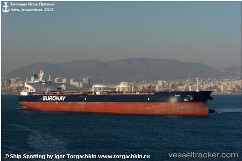
Vessel Maria IMO: 9530890, MMSI: 241079000 Crude Oil Tanker
UTC, 13.21085, -150.47505, course: 314, speed: 10.3
UTC, 13.36715, -150.63292, course: 317, speed: 10.5
2026-02-26 17:22:47 UTC, 13.59267, -150.86472, course: 321, speed: 10.4
Live AIS position:
UTC. 362 nm W of Santa Rita),
updated 2026-02-26 17:22:47 UTC.
Find the position of the vessel Maria on the map. The latter are known coordinates and path.
marine traffic ship tracker show on live map
The current position of vessel Maria is 13.59267 lat / -150.86472 lng. Updated: 2026-02-26 17:22:47 UTCCurrently sailing under the flag of Greece
Maria built in 2012 year
Deadweight:
159600 tDetails:
Last coordinates of the vessel:
UTC, 12.93712, -150.20732, course: 317, speed: 10.4UTC, 13.21085, -150.47505, course: 314, speed: 10.3
UTC, 13.36715, -150.63292, course: 317, speed: 10.5
2026-02-26 17:22:47 UTC, 13.59267, -150.86472, course: 321, speed: 10.4