 vesseltracker.com
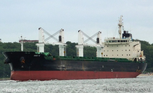
Vessel Angy R IMO: 9530955, MMSI: 311053100 Bulk Carrier
UTC, 36.40732, -4.43957, course: 349, speed: 2.5
UTC, 36.43711, -4.39487, course: 1, speed: 3.2
2026-01-25 07:54:00 UTC, 36.48343, -4.29975, course: 1, speed: 3.5
Live AIS position:
UTC. 13 nm SE of Arroyo de la Miel),
updated 2026-01-25 07:54:00 UTC.
Find the position of the vessel Angy R on the map. The latter are known coordinates and path.
marine traffic ship tracker show on live map
The current position of vessel Angy R is 36.48343 lat / -4.29975 lng. Updated: 2026-01-25 07:54:00 UTCDetails:
Last coordinates of the vessel:
UTC, 36.35353, -4.35708, course: 174, speed: 2.2UTC, 36.40732, -4.43957, course: 349, speed: 2.5
UTC, 36.43711, -4.39487, course: 1, speed: 3.2
2026-01-25 07:54:00 UTC, 36.48343, -4.29975, course: 1, speed: 3.5