 vesseltracker.com
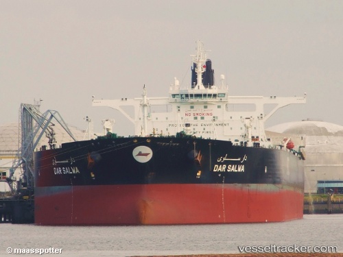
Vessel Dar Salwa IMO: 9534779, MMSI: 447131000 Crude Oil Tanker
UTC, 14.51733, 70.06558, course: 127, speed: 12.9
UTC, 14.30637, 70.30973, course: 128, speed: 13
2026-02-16 09:51:11 UTC, 14.05436, 70.61650, course: 122, speed: 12.9
Live AIS position:
UTC. 201 nm SW of Marmagao (Marmugao)),
updated 2026-02-16 09:51:11 UTC.
Find the position of the vessel Dar Salwa on the map. The latter are known coordinates and path.
marine traffic ship tracker show on live map
The current position of vessel Dar Salwa is 14.05436 lat / 70.61650 lng. Updated: 2026-02-16 09:51:11 UTCCurrently sailing under the flag of Kuwait
Dar Salwa built in 2010 year
Deadweight:
319761 tDetails:
Last coordinates of the vessel:
UTC, 14.83370, 69.70673, course: 130, speed: 12.8UTC, 14.51733, 70.06558, course: 127, speed: 12.9
UTC, 14.30637, 70.30973, course: 128, speed: 13
2026-02-16 09:51:11 UTC, 14.05436, 70.61650, course: 122, speed: 12.9