.
vessel Aquahaha IMO: 9536155, Bulk Carrier
vesseltracker.com
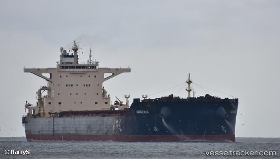
Vessel Aquahaha IMO: 9536155, MMSI: 636016674 Bulk Carrier

callsign: D5AW5
size: 45x292

Live AIS position: UTC. Near SHANHAIGUAN), updated 2025-12-03 04:26:05 UTC.

Find the position of the vessel Aquahaha on the map. The latter are known coordinates and path.

marine traffic ship tracker show on live map

The current position of vessel Aquahaha is 39.97039 lat / 119.82597 lng. Updated: 2025-12-03 04:26:05 UTC
Details:


Last coordinates of the vessel:
2025-12-03 04:26:05 UTC, 39.97039, 119.82597, course: 61, speed: 0


Most frequent ports a vessels calls at Aquahaha (636016674):

Ras Gharib, traffic: 4
Port Said, traffic: 2
Ra’S Shukhayr, traffic: 2
Ayn Sukhnah, traffic: 2
Bur Ibrahim, traffic: 2
Selat Lombok, traffic: 2
Uskudar, traffic: 2
Istanbul, traffic: 2
Wusong, traffic: 1
Yeosu, traffic: 1
Yosu, traffic: 1
Port Headland, traffic: 1
Rio De Janeiro, traffic: 1
Dampier, traffic: 1
Sambu, traffic: 1

Link to the map:


Find another ship

Aquahaha (636016674) last ports (portcalls and passsages)

Harwich | 2023-11-06 10:25:10
Yosu | 2023-05-08 04:01:18
Selat Lombok | 2023-04-19 06:44:10
Port Headland | 2023-04-15 03:24:49
Dagu Bar | 2023-01-28 20:20:22
Taku Bar | 2023-01-26 05:48:00
Dampier | 2023-01-03 17:48:18
Selat Lombok | 2022-12-28 00:02:08
Rio De Janeiro | 2022-10-22 22:33:55
Singapore | 2022-09-04 05:06:34
Wusong | 2022-03-20 06:51:13
Ras Gharib | 2022-02-08 02:52:21
Uskudar | 2022-01-22 13:20:06
Port Said | 2022-01-18 17:50:23
Bur Ibrahim | 2022-01-18 08:18:43
Ayn Sukhnah | 2021-12-29 19:55:22
Ras Gharib | 2021-12-29 11:57:20
Ra’S Shukhayr | 2021-12-29 10:11:38