 vesseltracker.com
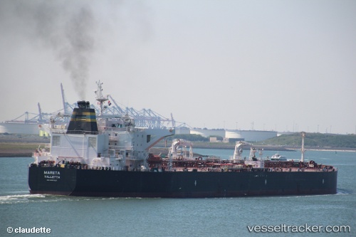
Vessel MARETA IMO: 9537927, MMSI: 636022898 Crude Oil Tanker
UTC, 44.37567, 8.87415, course: 56, speed: 0
UTC, 44.37606, 8.87406, course: 65, speed: 0
2026-02-26 07:38:17 UTC, 44.37609, 8.87408, course: 67, speed: 0
Live AIS position:
UTC. Near Genova),
updated 2026-02-26 07:38:17 UTC.
Find the position of the vessel MARETA on the map. The latter are known coordinates and path.
marine traffic ship tracker show on live map
The current position of vessel MARETA is 44.37609 lat / 8.87408 lng. Updated: 2026-02-26 07:38:17 UTCCurrently sailing under the flag of Liberia
MARETA built in 2013 year
Deadweight:
115795 tDetails:
Last coordinates of the vessel:
UTC, 44.37564, 8.87418, course: 53, speed: 0UTC, 44.37567, 8.87415, course: 56, speed: 0
UTC, 44.37606, 8.87406, course: 65, speed: 0
2026-02-26 07:38:17 UTC, 44.37609, 8.87408, course: 67, speed: 0