 vesseltracker.com
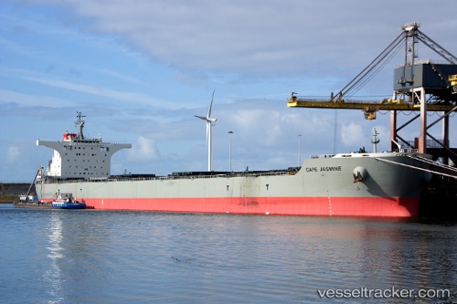
Vessel CAPE JASMINE IMO: 9538751, MMSI: 601002650 Bulk Carrier
UTC, -31.23755, 35.91497, course: 249, speed: 12.4
UTC, -31.41167, 35.38167, course: -1, speed: 11
2026-02-09 07:35:07 UTC, -31.54375, 35.05387, course: 243, speed: 11.3
Live AIS position:
UTC. 222 nm SE of Richards Bay),
updated 2026-02-09 07:35:07 UTC.
Find the position of the vessel CAPE JASMINE on the map. The latter are known coordinates and path.
marine traffic ship tracker show on live map
The current position of vessel CAPE JASMINE is -31.54375 lat / 35.05387 lng. Updated: 2026-02-09 07:35:07 UTCCurrently sailing under the flag of South Africa
CAPE JASMINE built in 2012 year
Deadweight:
176330 tDetails:
Last coordinates of the vessel:
UTC, -31.15333, 36.14667, course: -1, speed: 11UTC, -31.23755, 35.91497, course: 249, speed: 12.4
UTC, -31.41167, 35.38167, course: -1, speed: 11
2026-02-09 07:35:07 UTC, -31.54375, 35.05387, course: 243, speed: 11.3