 vesseltracker.com
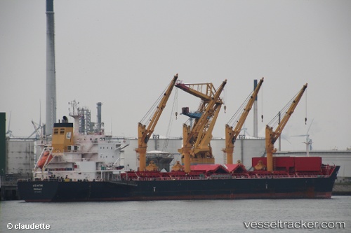
Vessel MAKRA IMO: 9541813, MMSI: 311001036 Bulk Carrier
UTC, 0.09338, -50.96148, course: 242, speed: 0.1
UTC, 0.09400, -50.96151, course: 230, speed: 0.1
2026-02-23 16:32:18 UTC, 0.09368, -50.96062, course: 193, speed: 0.1
Live AIS position:
UTC. Near MACAPA),
updated 2026-02-23 16:32:18 UTC.
Find the position of the vessel MAKRA on the map. The latter are known coordinates and path.
marine traffic ship tracker show on live map
The current position of vessel MAKRA is 0.09368 lat / -50.96062 lng. Updated: 2026-02-23 16:32:18 UTCCurrently sailing under the flag of Bahamas
MAKRA built in 2012 year
Deadweight:
58451 tDetails:
Last coordinates of the vessel:
UTC, 0.09064, -50.96353, course: 20, speed: 0.1UTC, 0.09338, -50.96148, course: 242, speed: 0.1
UTC, 0.09400, -50.96151, course: 230, speed: 0.1
2026-02-23 16:32:18 UTC, 0.09368, -50.96062, course: 193, speed: 0.1