 vesseltracker.com
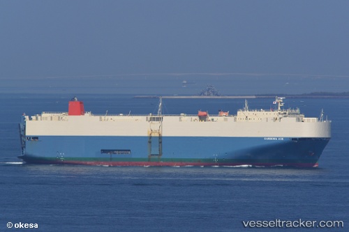
Vessel Gardenia Ace IMO: 9542295, MMSI: 636015370 Vehicles Carrier
UTC, 13.55288, 71.10268, course: 130, speed: 16.7
UTC, 13.22882, 71.48701, course: 134, speed: 17.2
2026-01-29 01:48:29 UTC, 12.76634, 71.97597, course: 131, speed: 16.7
Live AIS position:
UTC. 109 nm NW of Amini Island),
updated 2026-01-29 01:48:29 UTC.
Find the position of the vessel Gardenia Ace on the map. The latter are known coordinates and path.
marine traffic ship tracker show on live map
The current position of vessel Gardenia Ace is 12.76634 lat / 71.97597 lng. Updated: 2026-01-29 01:48:29 UTCDetails:
Last coordinates of the vessel:
UTC, 13.90550, 70.71261, course: 128, speed: 17.4UTC, 13.55288, 71.10268, course: 130, speed: 16.7
UTC, 13.22882, 71.48701, course: 134, speed: 17.2
2026-01-29 01:48:29 UTC, 12.76634, 71.97597, course: 131, speed: 16.7