 vesseltracker.com
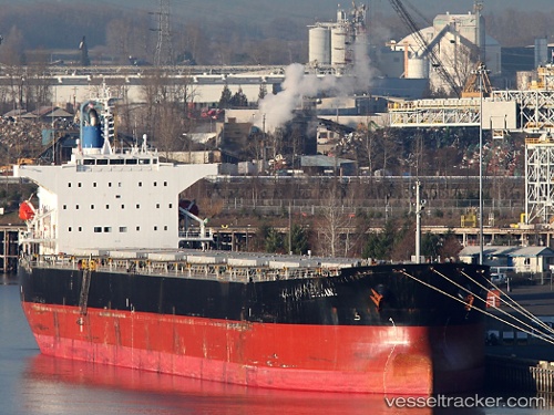
Vessel Bryant IMO: 9544700, MMSI: 538005193 Bulk Carrier
UTC, -32.98397, 32.70217, course: 76, speed: 12.8
UTC, -32.86007, 33.18668, course: 70, speed: 12.4
2026-02-14 10:14:53 UTC, -32.74190, 33.59472, course: 73, speed: 11.8
Live AIS position:
UTC. 200 nm SE of Ramsgate),
updated 2026-02-14 10:14:53 UTC.
Find the position of the vessel Bryant on the map. The latter are known coordinates and path.
marine traffic ship tracker show on live map
The current position of vessel Bryant is -32.74190 lat / 33.59472 lng. Updated: 2026-02-14 10:14:53 UTCDetails:
Last coordinates of the vessel:
UTC, -33.14862, 32.05412, course: 76, speed: 12.9UTC, -32.98397, 32.70217, course: 76, speed: 12.8
UTC, -32.86007, 33.18668, course: 70, speed: 12.4
2026-02-14 10:14:53 UTC, -32.74190, 33.59472, course: 73, speed: 11.8