 vesseltracker.com
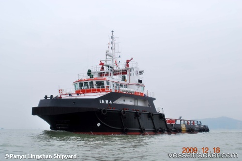
Vessel I.n.w 4 IMO: 9546851, MMSI: 372196000 Offshore Tug Supply Ship
UTC, 25.48430, 53.12780, course: 36, speed: 0.4
UTC, 25.48426, 53.12820, course: 335, speed: 0.1
2026-02-06 06:12:56 UTC, 25.48439, 53.12831, course: 334, speed: 0.1
Live AIS position:
UTC. Near Abu al Bukhoosh),
updated 2026-02-06 06:12:56 UTC.
Find the position of the vessel I.n.w 4 on the map. The latter are known coordinates and path.
marine traffic ship tracker show on live map
The current position of vessel I.n.w 4 is 25.48439 lat / 53.12831 lng. Updated: 2026-02-06 06:12:56 UTCDetails:
Last coordinates of the vessel:
UTC, 25.48429, 53.12822, course: 357, speed: 0.3UTC, 25.48430, 53.12780, course: 36, speed: 0.4
UTC, 25.48426, 53.12820, course: 335, speed: 0.1
2026-02-06 06:12:56 UTC, 25.48439, 53.12831, course: 334, speed: 0.1