 vesseltracker.com
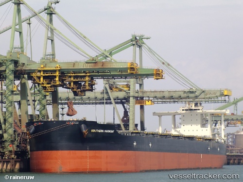
Vessel Southern Harmony IMO: 9552422, MMSI: 373508000 Bulk Carrier
UTC, 34.87897, 119.75271, course: 55, speed: 0
UTC, 34.87897, 119.75271, course: 55, speed: 0
2026-01-25 04:37:19 UTC, 34.87897, 119.75271, course: 55, speed: 0
Live AIS position:
UTC. 17 nm NE of Lianyungang),
updated 2026-01-25 04:37:19 UTC.
Find the position of the vessel Southern Harmony on the map. The latter are known coordinates and path.
marine traffic ship tracker show on live map
The current position of vessel Southern Harmony is 34.87897 lat / 119.75271 lng. Updated: 2026-01-25 04:37:19 UTCCurrently sailing under the flag of Panama
Southern Harmony built in 2012 year
Deadweight:
182249 tDetails:
Last coordinates of the vessel:
UTC, 34.87897, 119.75271, course: 55, speed: 0UTC, 34.87897, 119.75271, course: 55, speed: 0
UTC, 34.87897, 119.75271, course: 55, speed: 0
2026-01-25 04:37:19 UTC, 34.87897, 119.75271, course: 55, speed: 0