 vesseltracker.com
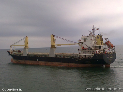
Vessel Chang Xiong IMO: 9553361, MMSI: 413380840 General Cargo Ship
UTC, 35.53005, 121.07450, course: 320, speed: 9
UTC, 35.75905, 120.89117, course: 334, speed: 9
2026-02-26 21:25:28 UTC, 35.86980, 120.83062, course: 325, speed: 9.3
Live AIS position:
UTC. 28 nm SE of Qingdao),
updated 2026-02-26 21:25:28 UTC.
Find the position of the vessel Chang Xiong on the map. The latter are known coordinates and path.
marine traffic ship tracker show on live map
The current position of vessel Chang Xiong is 35.86980 lat / 120.83062 lng. Updated: 2026-02-26 21:25:28 UTCDetails:
Last coordinates of the vessel:
UTC, 35.20193, 121.36427, course: 326, speed: 9.5UTC, 35.53005, 121.07450, course: 320, speed: 9
UTC, 35.75905, 120.89117, course: 334, speed: 9
2026-02-26 21:25:28 UTC, 35.86980, 120.83062, course: 325, speed: 9.3