 vesseltracker.com
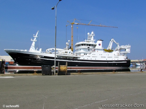
Vessel Christina E IMO: 9554573, MMSI: 257032500 Fish Carrier
UTC, 62.32429, 5.66306, course: 242, speed: 0
UTC, 62.32425, 5.66308, course: 243, speed: 0
2026-01-28 22:20:00 UTC, 62.32427, 5.66312, course: 241, speed: 0
Live AIS position:
UTC. Near Mjølstadneset),
updated 2026-01-28 22:20:00 UTC.
Find the position of the vessel Christina E on the map. The latter are known coordinates and path.
marine traffic ship tracker show on live map
The current position of vessel Christina E is 62.32427 lat / 5.66312 lng. Updated: 2026-01-28 22:20:00 UTCCurrently sailing under the flag of Norway
Christina E built in 2011 year
Deadweight:
3500 tDetails:
Last coordinates of the vessel:
UTC, 62.32429, 5.66307, course: 243, speed: 0UTC, 62.32429, 5.66306, course: 242, speed: 0
UTC, 62.32425, 5.66308, course: 243, speed: 0
2026-01-28 22:20:00 UTC, 62.32427, 5.66312, course: 241, speed: 0