 vesseltracker.com
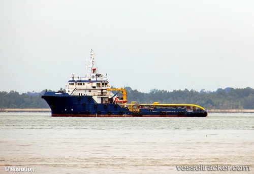
Vessel Harrier IMO: 9555838, MMSI: 525016552 Offshore Tug Supply Ship
UTC, -5.93667, 107.72167, course: -1, speed: 0
UTC, -5.93581, 107.72074, course: -1, speed: 0.3
2026-02-11 16:27:19 UTC, -5.93012, 107.70934, course: -1, speed: 0.1
Live AIS position:
UTC. 29 nm NE of Rengasdengklok),
updated 2026-02-11 16:27:19 UTC.
Find the position of the vessel Harrier on the map. The latter are known coordinates and path.
marine traffic ship tracker show on live map
The current position of vessel Harrier is -5.93012 lat / 107.70934 lng. Updated: 2026-02-11 16:27:19 UTCCurrently sailing under the flag of Indonesia
Details:
Last coordinates of the vessel:
UTC, -5.93333, 107.71667, course: -1, speed: 0UTC, -5.93667, 107.72167, course: -1, speed: 0
UTC, -5.93581, 107.72074, course: -1, speed: 0.3
2026-02-11 16:27:19 UTC, -5.93012, 107.70934, course: -1, speed: 0.1