 vesseltracker.com
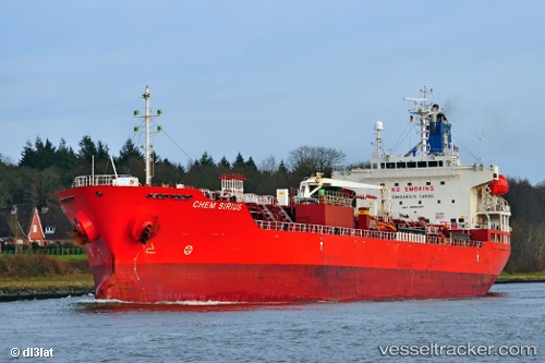
Vessel Chem Sirius IMO: 9558397, MMSI: 636017165 Chemical Oil Products Tanker
UTC, 24.61574, -86.27590, course: 138, speed: 13.8
UTC, 24.26290, -85.88926, course: 137, speed: 13.6
2026-01-20 03:19:29 UTC, 24.13079, -85.70524, course: 128, speed: 13.6
Live AIS position:
UTC. 128 nm NW of Santa Lucia),
updated 2026-01-20 03:19:29 UTC.
Find the position of the vessel Chem Sirius on the map. The latter are known coordinates and path.
marine traffic ship tracker show on live map
The current position of vessel Chem Sirius is 24.13079 lat / -85.70524 lng. Updated: 2026-01-20 03:19:29 UTCCurrently sailing under the flag of Liberia
Chem Sirius built in 2011 year
Deadweight:
19986 tDetails:
Last coordinates of the vessel:
UTC, 24.79746, -86.47429, course: 135, speed: 13.3UTC, 24.61574, -86.27590, course: 138, speed: 13.8
UTC, 24.26290, -85.88926, course: 137, speed: 13.6
2026-01-20 03:19:29 UTC, 24.13079, -85.70524, course: 128, speed: 13.6