 vesseltracker.com
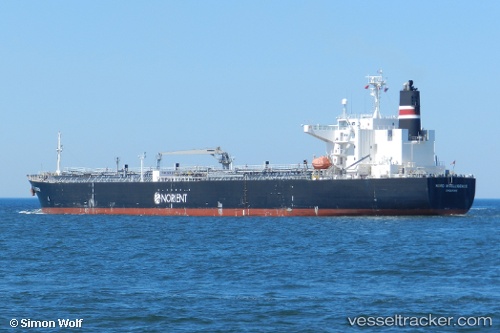
Vessel EL BELLA IMO: 9561368, MMSI: 352005734 Oil Products Tanker
UTC, 1.32875, 103.36445, course: 115, speed: 0
UTC, 1.32863, 103.36458, course: 109, speed: 0.1
2026-02-25 17:54:30 UTC, 1.32767, 103.36440, course: -1, speed: 0
Live AIS position:
UTC. 11 nm W of TANJUNG PELEPAS),
updated 2026-02-25 17:54:30 UTC.
Find the position of the vessel EL BELLA on the map. The latter are known coordinates and path.
marine traffic ship tracker show on live map
The current position of vessel EL BELLA is 1.32767 lat / 103.36440 lng. Updated: 2026-02-25 17:54:30 UTCCurrently sailing under the flag of Panama
Details:
Last coordinates of the vessel:
UTC, 1.32793, 103.36418, course: 114, speed: 0UTC, 1.32875, 103.36445, course: 115, speed: 0
UTC, 1.32863, 103.36458, course: 109, speed: 0.1
2026-02-25 17:54:30 UTC, 1.32767, 103.36440, course: -1, speed: 0