 vesseltracker.com
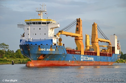
Vessel Bbc Amber IMO: 9563706, MMSI: 305717000 Multi Purpose Carrier
UTC, 33.30833, 132.00333, course: -1, speed: 16
UTC, 33.76839, 132.44817, course: 48, speed: 15.5
2026-02-06 07:28:27 UTC, 34.00959, 132.54608, course: 281, speed: 15.9
Live AIS position:
UTC. Near TSUWAJI),
updated 2026-02-06 07:28:27 UTC.
Find the position of the vessel Bbc Amber on the map. The latter are known coordinates and path.
marine traffic ship tracker show on live map
The current position of vessel Bbc Amber is 34.00959 lat / 132.54608 lng. Updated: 2026-02-06 07:28:27 UTCDetails:
Last coordinates of the vessel:
UTC, 32.82894, 132.37067, course: 333, speed: 15.1UTC, 33.30833, 132.00333, course: -1, speed: 16
UTC, 33.76839, 132.44817, course: 48, speed: 15.5
2026-02-06 07:28:27 UTC, 34.00959, 132.54608, course: 281, speed: 15.9