 vesseltracker.com
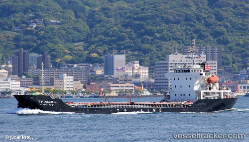
Vessel Ty Noble IMO: 9565209, MMSI: 441631000 General Cargo Ship
UTC, 16.61126, 120.30263, course: 244, speed: 0
UTC, 16.61130, 120.30260, course: 244, speed: 0.1
2026-02-06 23:34:58 UTC, 16.63889, 120.28117, course: 251, speed: 10.2
Live AIS position:
UTC. Near San Fernando),
updated 2026-02-06 23:34:58 UTC.
Find the position of the vessel Ty Noble on the map. The latter are known coordinates and path.
marine traffic ship tracker show on live map
The current position of vessel Ty Noble is 16.63889 lat / 120.28117 lng. Updated: 2026-02-06 23:34:58 UTCCurrently sailing under the flag of Korea
Ty Noble built in 2009 year
Deadweight:
6238 tDetails:
Last coordinates of the vessel:
UTC, 16.61127, 120.30264, course: 244, speed: 0UTC, 16.61126, 120.30263, course: 244, speed: 0
UTC, 16.61130, 120.30260, course: 244, speed: 0.1
2026-02-06 23:34:58 UTC, 16.63889, 120.28117, course: 251, speed: 10.2