 vesseltracker.com
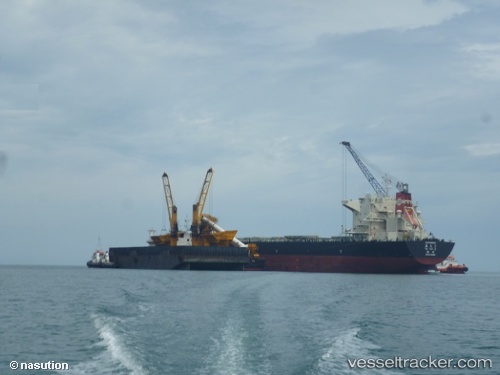
Vessel Ya Tai 2 IMO: 9568160, MMSI: 412057000 Bulk Carrier
UTC, 14.48967, 120.63140, course: 87, speed: 0
UTC, 14.48907, 120.63151, course: 70, speed: 0.1
2026-02-03 15:17:40 UTC, 14.48832, 120.63202, course: 50, speed: 0
Live AIS position:
UTC. Near LIMAY),
updated 2026-02-03 15:17:40 UTC.
Find the position of the vessel Ya Tai 2 on the map. The latter are known coordinates and path.
marine traffic ship tracker show on live map
The current position of vessel Ya Tai 2 is 14.48832 lat / 120.63202 lng. Updated: 2026-02-03 15:17:40 UTCCurrently sailing under the flag of China
Ya Tai 2 built in 2012 year
Deadweight:
76022 tDetails:
Last coordinates of the vessel:
UTC, 14.48882, 120.63164, course: 68, speed: 0UTC, 14.48967, 120.63140, course: 87, speed: 0
UTC, 14.48907, 120.63151, course: 70, speed: 0.1
2026-02-03 15:17:40 UTC, 14.48832, 120.63202, course: 50, speed: 0