 vesseltracker.com
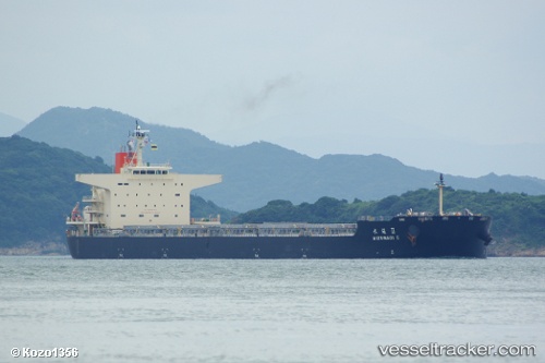
Vessel Mizunagi Ii IMO: 9568213, MMSI: 372885000 Bulk Carrier
UTC, -1.99011, 118.58485, course: 187, speed: 11.1
UTC, -2.32951, 118.53838, course: 191, speed: 11.7
2026-02-08 11:55:21 UTC, -2.69321, 118.46791, course: 191, speed: 11
Live AIS position:
UTC. 105 nm NW of PARE PARE),
updated 2026-02-08 11:55:21 UTC.
Find the position of the vessel Mizunagi Ii on the map. The latter are known coordinates and path.
marine traffic ship tracker show on live map
The current position of vessel Mizunagi Ii is -2.69321 lat / 118.46791 lng. Updated: 2026-02-08 11:55:21 UTCCurrently sailing under the flag of Panama
Mizunagi Ii built in 2010 year
Deadweight:
92125 tDetails:
Last coordinates of the vessel:
UTC, -1.52405, 118.67698, course: 192, speed: 10.9UTC, -1.99011, 118.58485, course: 187, speed: 11.1
UTC, -2.32951, 118.53838, course: 191, speed: 11.7
2026-02-08 11:55:21 UTC, -2.69321, 118.46791, course: 191, speed: 11