 vesseltracker.com
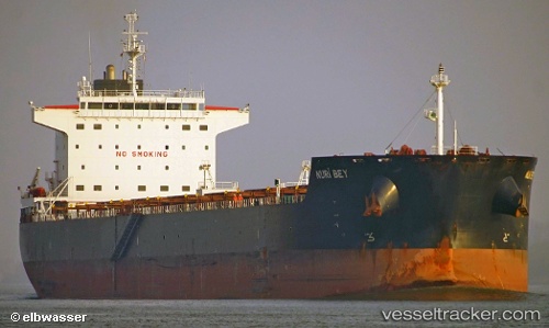
Vessel Nuri Bey IMO: 9569750, MMSI: 271042638 Bulk Carrier
UTC, -24.10039, -46.24545, course: 109, speed: 0
UTC, -24.10005, -46.24532, course: 120, speed: 0
2026-02-25 15:32:16 UTC, -24.09959, -46.24492, course: 132, speed: 0
Live AIS position:
UTC. Near Guarujá),
updated 2026-02-25 15:32:16 UTC.
Find the position of the vessel Nuri Bey on the map. The latter are known coordinates and path.
marine traffic ship tracker show on live map
The current position of vessel Nuri Bey is -24.09959 lat / -46.24492 lng. Updated: 2026-02-25 15:32:16 UTCDetails:
Last coordinates of the vessel:
UTC, -24.10027, -46.24536, course: 110, speed: 0UTC, -24.10039, -46.24545, course: 109, speed: 0
UTC, -24.10005, -46.24532, course: 120, speed: 0
2026-02-25 15:32:16 UTC, -24.09959, -46.24492, course: 132, speed: 0