 vesseltracker.com
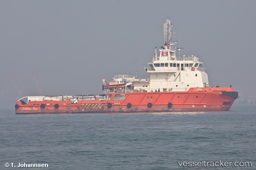
Vessel L J Johnson IMO: 9576363, MMSI: 419000208 Offshore Tug Supply Ship
UTC, 19.49113, 71.26220, course: 309, speed: 3.9
UTC, 19.62077, 71.26048, course: 235, speed: 2.5
2026-02-19 12:01:30 UTC, 19.59275, 71.21443, course: 183, speed: 2.6
Live AIS position:
UTC. 76 nm S of Jafarabad),
updated 2026-02-19 12:01:30 UTC.
Find the position of the vessel L J Johnson on the map. The latter are known coordinates and path.
marine traffic ship tracker show on live map
The current position of vessel L J Johnson is 19.59275 lat / 71.21443 lng. Updated: 2026-02-19 12:01:30 UTCDetails:
Last coordinates of the vessel:
UTC, 19.48338, 71.40012, course: 253, speed: 1.8UTC, 19.49113, 71.26220, course: 309, speed: 3.9
UTC, 19.62077, 71.26048, course: 235, speed: 2.5
2026-02-19 12:01:30 UTC, 19.59275, 71.21443, course: 183, speed: 2.6