 vesseltracker.com
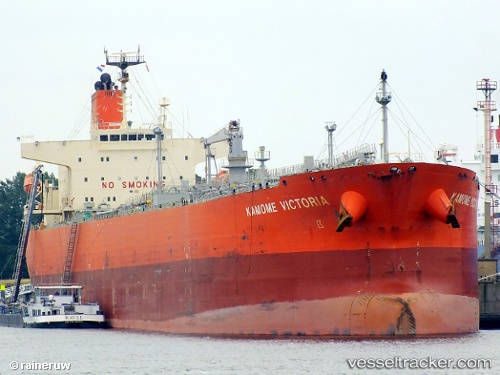
Vessel Kamome Victoria IMO: 9584102, MMSI: 353525000 Oil Products Tanker
UTC, 13.25667, 71.34075, course: 321, speed: 13.6
UTC, 13.56878, 70.92962, course: 315, speed: 11.7
2026-02-28 03:42:07 UTC, 13.82456, 70.65882, course: 322, speed: 11.8
Live AIS position:
UTC. 203 nm NW of Amini Island),
updated 2026-02-28 03:42:07 UTC.
Find the position of the vessel Kamome Victoria on the map. The latter are known coordinates and path.
marine traffic ship tracker show on live map
The current position of vessel Kamome Victoria is 13.82456 lat / 70.65882 lng. Updated: 2026-02-28 03:42:07 UTCCurrently sailing under the flag of Panama
Kamome Victoria built in 2011 year
Deadweight:
74908 tDetails:
Last coordinates of the vessel:
UTC, 12.98991, 71.69767, course: 306, speed: 13.5UTC, 13.25667, 71.34075, course: 321, speed: 13.6
UTC, 13.56878, 70.92962, course: 315, speed: 11.7
2026-02-28 03:42:07 UTC, 13.82456, 70.65882, course: 322, speed: 11.8