 vesseltracker.com
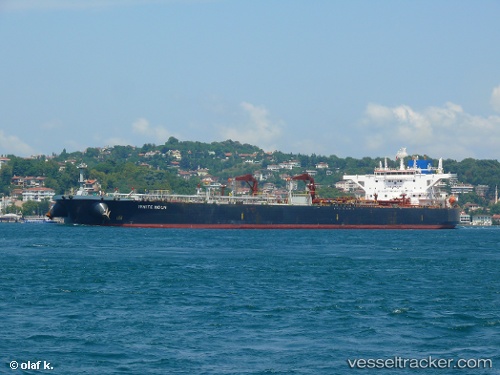
Vessel White Moon IMO: 9588158, MMSI: 636016128 Crude Oil Tanker
UTC, 34.47892, 21.13231, course: 287, speed: 12.3
UTC, 34.79959, 20.10730, course: 296, speed: 11.8
2026-02-19 14:13:23 UTC, 35.04171, 19.39815, course: 287, speed: 12.2
Live AIS position:
UTC. 81 nm NE of Pinelands),
updated 2026-02-19 14:13:23 UTC.
Find the position of the vessel White Moon on the map. The latter are known coordinates and path.
marine traffic ship tracker show on live map
The current position of vessel White Moon is 35.04171 lat / 19.39815 lng. Updated: 2026-02-19 14:13:23 UTCDetails:
Last coordinates of the vessel:
UTC, 34.47892, 21.13231, course: 287, speed: 12.3UTC, 34.47892, 21.13231, course: 287, speed: 12.3
UTC, 34.79959, 20.10730, course: 296, speed: 11.8
2026-02-19 14:13:23 UTC, 35.04171, 19.39815, course: 287, speed: 12.2