 vesseltracker.com
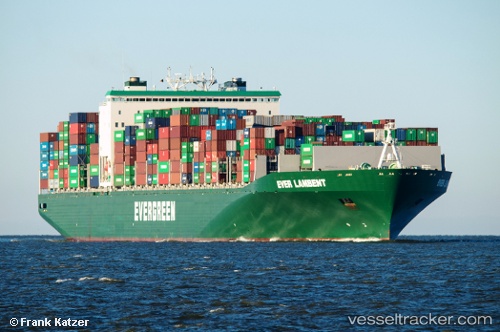
Vessel Ever Lambent IMO: 9595436, MMSI: 235093569 Container Ship
UTC, 16.78567, 131.23428, course: 290, speed: 15.6
UTC, 16.91120, 130.84076, course: 289, speed: 15.8
2026-02-13 12:46:24 UTC, 17.02800, 130.46667, course: 290, speed: 15.8
Live AIS position:
UTC. Open sea, approx. 403 nm off the nearest listed port),
updated 2026-02-13 12:46:24 UTC.
Find the position of the vessel Ever Lambent on the map. The latter are known coordinates and path.
marine traffic ship tracker show on live map
The current position of vessel Ever Lambent is 17.02800 lat / 130.46667 lng. Updated: 2026-02-13 12:46:24 UTCDetails:
Last coordinates of the vessel:
UTC, 16.62144, 131.74429, course: 289, speed: 15.7UTC, 16.78567, 131.23428, course: 290, speed: 15.6
UTC, 16.91120, 130.84076, course: 289, speed: 15.8
2026-02-13 12:46:24 UTC, 17.02800, 130.46667, course: 290, speed: 15.8