 vesseltracker.com
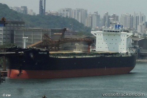
Vessel Tahiti One IMO: 9597032, MMSI: 229177000 Bulk Carrier
UTC, -14.85167, 63.82333, course: -1, speed: 10
UTC, -14.64058, 64.14343, course: 60, speed: 10
2026-03-01 23:37:07 UTC, -14.50833, 64.34333, course: -1, speed: 9
Live AIS position:
UTC. 315 nm N of Port Mathurin),
updated 2026-03-01 23:37:07 UTC.
Find the position of the vessel Tahiti One on the map. The latter are known coordinates and path.
marine traffic ship tracker show on live map
The current position of vessel Tahiti One is -14.50833 lat / 64.34333 lng. Updated: 2026-03-01 23:37:07 UTCDetails:
Last coordinates of the vessel:
UTC, -14.97972, 63.62902, course: 61, speed: 9.8UTC, -14.85167, 63.82333, course: -1, speed: 10
UTC, -14.64058, 64.14343, course: 60, speed: 10
2026-03-01 23:37:07 UTC, -14.50833, 64.34333, course: -1, speed: 9