 vesseltracker.com
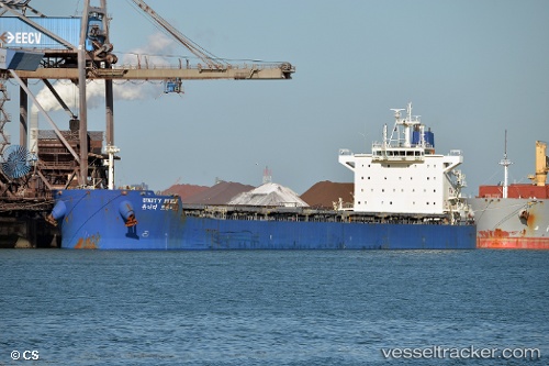
Vessel Syros I IMO: 9597800, MMSI: 636017002 Bulk Carrier
UTC, 53.87998, -5.16004, course: 198, speed: 1.1
UTC, 53.89675, -5.21265, course: 177, speed: 1.3
2026-01-29 20:18:24 UTC, 53.86687, -5.30975, course: 193, speed: 6.5
Live AIS position:
UTC. 22 nm E of Ellerton),
updated 2026-01-29 20:18:24 UTC.
Find the position of the vessel Syros I on the map. The latter are known coordinates and path.
marine traffic ship tracker show on live map
The current position of vessel Syros I is 53.86687 lat / -5.30975 lng. Updated: 2026-01-29 20:18:24 UTCCurrently sailing under the flag of Liberia
Syros I built in 2011 year
Deadweight:
81393 tDetails:
Last coordinates of the vessel:
UTC, 53.86741, -5.12457, course: 193, speed: 1.3UTC, 53.87998, -5.16004, course: 198, speed: 1.1
UTC, 53.89675, -5.21265, course: 177, speed: 1.3
2026-01-29 20:18:24 UTC, 53.86687, -5.30975, course: 193, speed: 6.5