 vesseltracker.com
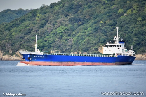
Vessel No.18 Koun Maru IMO: 9601651, MMSI: 431002306 General Cargo Ship
UTC, 34.72722, 136.85095, course: 317, speed: 8.9
UTC, 34.95103, 136.67537, course: 295, speed: 0.3
2026-02-08 16:01:19 UTC, 34.95103, 136.67537, course: 295, speed: 0.3
Live AIS position:
UTC. Near Yokkaichi),
updated 2026-02-08 16:01:19 UTC.
Find the position of the vessel No.18 Koun Maru on the map. The latter are known coordinates and path.
marine traffic ship tracker show on live map
The current position of vessel No.18 Koun Maru is 34.95103 lat / 136.67537 lng. Updated: 2026-02-08 16:01:19 UTCDetails:
Last coordinates of the vessel:
UTC, 34.72722, 136.85095, course: 317, speed: 8.9UTC, 34.72722, 136.85095, course: 317, speed: 8.9
UTC, 34.95103, 136.67537, course: 295, speed: 0.3
2026-02-08 16:01:19 UTC, 34.95103, 136.67537, course: 295, speed: 0.3