 vesseltracker.com
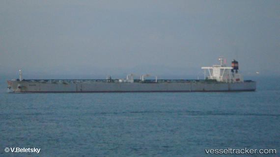
Vessel MAXIM IMO: 9604079, MMSI: 538009417 Crude Oil Tanker
UTC, -23.12167, -44.41167, course: -1, speed: 0
UTC, -23.12167, -44.41167, course: -1, speed: 0
2026-02-27 16:13:14 UTC, -23.12167, -44.41167, course: -1, speed: 0
Live AIS position:
UTC. Near Angra Dos Reis),
updated 2026-02-27 16:13:14 UTC.
Find the position of the vessel MAXIM on the map. The latter are known coordinates and path.
marine traffic ship tracker show on live map
The current position of vessel MAXIM is -23.12167 lat / -44.41167 lng. Updated: 2026-02-27 16:13:14 UTCCurrently sailing under the flag of Marshall Islands
MAXIM built in 2011 year
Deadweight:
296887 tDetails:
Last coordinates of the vessel:
UTC, -23.12167, -44.41167, course: -1, speed: 0UTC, -23.12167, -44.41167, course: -1, speed: 0
UTC, -23.12167, -44.41167, course: -1, speed: 0
2026-02-27 16:13:14 UTC, -23.12167, -44.41167, course: -1, speed: 0